South Florida Local News
Florida Seafloor Mapping Initiative reaches major milestone with new discoveries beneath the state’s coastal waters
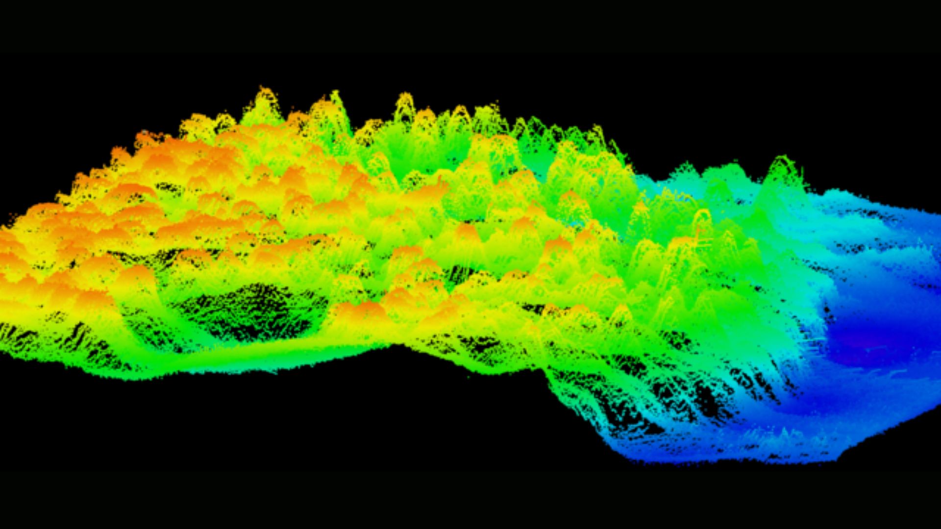
Tallahassee, Florida – The Florida Department of Environmental Protection (DEP) announced a significant achievement in the Florida Seafloor Mapping Initiative (FSMI), completing the collection of all airborne LiDAR data and receiving the majority of vessel-based sonar information used to map the state’s coastal waters. Florida is now the only state in the nation conducting a seafloor mapping effort on such a comprehensive scale. Once finalized, FSMI will deliver the most detailed map of Florida’s seafloor ever produced, with the data expected to be publicly available in fall 2026.
“Florida’s coastline is one of our state’s greatest natural and economic assets, supporting millions of residents, tourism, commercial fisheries and critical infrastructure,” said DEP Secretary Alexis A. Lambert. “Understanding the seafloor and the features that shape our coast helps us make smart decisions about protecting communities, strengthening resilience and investing taxpayer dollars where they will have the greatest impact.”
FSMI combines advanced technologies to capture precise bathymetric data across both shallow and deep waters. Airborne LiDAR systems measure water depths using laser pulses, scanning vast areas quickly and efficiently, while vessel-based multibeam sonar provides high-resolution maps of deeper waters. By merging these techniques, scientists can obtain a complete picture of Florida’s underwater landscape—from nearshore seagrass beds to deep offshore formations.
High-resolution seafloor data plays a critical role in coastal management and environmental protection. The information helps identify offshore sand sources for beach nourishment projects, improves storm surge and flood modeling, and guides the restoration and protection of coral reefs and seagrass habitats.
“Through FSMI, we have mapped more than 75,500 square kilometers using LiDAR and more than 64,000 square kilometers using sonar technologies,” said Florida Geographic Information Officer Kimberly Jackson. “Before this initiative began, only about 25,600 square kilometers of Florida’s seafloor had been mapped. Today, we have mapped more than 14 times that amount, giving Florida an unprecedented understanding of its underwater landscape.”
Early analysis of FSMI data is already revealing previously unknown features beneath Florida’s waters. Researchers have discovered ancient shorelines, buried river channels, karst formations, and offshore sand deposits that may be crucial for future beach nourishment efforts. These findings provide insights into the state’s geological history, shedding light on how Florida’s coastal environment has evolved over millennia.
One of the most exciting discoveries involves previously unidentified mesophotic coral reefs. Unlike Florida’s shallow reefs, these ecosystems thrive in deeper waters with lower light levels. DEP is partnering with the National Oceanic and Atmospheric Administration (NOAA) to explore these reefs using remotely operated vehicle dives and scientific sampling. Understanding these deeper coral ecosystems may help scientists protect critical marine biodiversity and ensure the health of Florida’s reefs for future generations.
FSMI data is also being integrated with inland elevation datasets through collaboration with the U.S. Geological Survey’s Coastal National Elevation Database Applications Project. This combined effort will create a seamless statewide digital elevation model extending from upland areas to offshore waters. The resulting model will provide planners, environmental managers, and policymakers with a holistic view of Florida’s landscape, supporting resilient and cost-effective infrastructure investments and disaster preparedness strategies.
The initiative highlights Florida’s commitment to scientific innovation, environmental stewardship, and sustainable coastal management. By producing a detailed map of the seafloor, FSMI equips state agencies and local governments with the tools to make informed decisions that protect both natural resources and communities.
“FSMI represents a leap forward in understanding the state’s coastal environment,” Lambert added. “The data we are collecting today will serve generations of Floridians, supporting smarter planning, better conservation efforts, and more effective responses to natural hazards.”
As the Florida Seafloor Mapping Initiative approaches its final stages, DEP encourages scientists, educators, and the public to explore the data once it becomes available in fall 2026.
The initiative promises to transform how Florida studies, protects, and manages its valuable coastal and marine resources.
For more information about the Florida Seafloor Mapping Initiative, visit FloridaGIO.gov.
Credit: Florida Department of Environmental Protection


Pembroke Pines invites community members to opening reception of Kaleidoscope Shifting Perspectives featuring South Florida artists

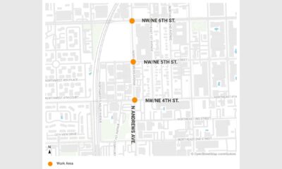
Andrews Avenue asphalt improvement project postponed as Fort Lauderdale prepares for future roadway upgrades

City of Pompano Beach announces temporary waterway closure beneath McNab Road Bridge as major construction work enters critical phase

Body found on Commercial Boulevard as Fort Lauderdale police investigate suspected hit-and-run

Hammonton native and Army veteran Bart DiGuglielmo killed in Florida Walmart parking lot shooting dispute

Fort Lauderdale Issues Precautionary Waterway Advisory After Sewer Overflow Impacts Intracoastal Waterway Area

West Palm Beach Mayor and City Commission set maximum millage rate for 2026/2027 fiscal year budget planning

BCPS celebrates three additional students earning 2026 National Merit College-Sponsored Scholarships for academic excellence

Greater Fort Lauderdale Alliance’s David Coddington begins leadership role as Florida Economic Development Council chair for 2026-2027

Florida Department of Health warns residents about dangerous opioid-like 7-OH products being sold in stores across the state

Fort Lauderdale begins Andrews Avenue Asphalt Improvement Project to improve roadway conditions in Flagler Village area

Plantation Utilities reassures residents about drinking water safety and explains how regular testing ensures quality standards

Florida man arrested after allegedly submitting more than $159,000 in fraudulent insurance claims

Five BCPS non-traditional schools earn commendable ratings for academic progress and student achievement

Pompano Beach City Commission Budget Workshop moves location to Commission Chambers for full livestream access
-
 South Florida Local News2 days ago
Hammonton native and Army veteran Bart DiGuglielmo killed in Florida Walmart parking lot shooting dispute
-
 South Florida Local News4 days ago
Fort Lauderdale begins Andrews Avenue Asphalt Improvement Project to improve roadway conditions in Flagler Village area
-
 South Florida Local News23 hours ago
Body found on Commercial Boulevard as Fort Lauderdale police investigate suspected hit-and-run
-
 South Florida Local News3 days ago
BCPS celebrates three additional students earning 2026 National Merit College-Sponsored Scholarships for academic excellence