South Florida Local News
Florida Seafloor Mapping Initiative reaches major milestone with new discoveries beneath the state’s coastal waters

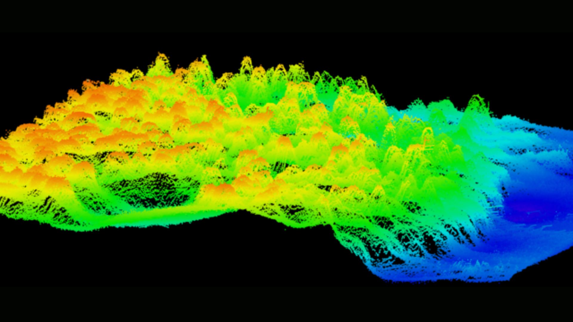
Tallahassee, Florida – The Florida Department of Environmental Protection (DEP) announced a significant achievement in the Florida Seafloor Mapping Initiative (FSMI), completing the collection of all airborne LiDAR data and receiving the majority of vessel-based sonar information used to map the state’s coastal waters. Florida is now the only state in the nation conducting a seafloor mapping effort on such a comprehensive scale. Once finalized, FSMI will deliver the most detailed map of Florida’s seafloor ever produced, with the data expected to be publicly available in fall 2026.
“Florida’s coastline is one of our state’s greatest natural and economic assets, supporting millions of residents, tourism, commercial fisheries and critical infrastructure,” said DEP Secretary Alexis A. Lambert. “Understanding the seafloor and the features that shape our coast helps us make smart decisions about protecting communities, strengthening resilience and investing taxpayer dollars where they will have the greatest impact.”
FSMI combines advanced technologies to capture precise bathymetric data across both shallow and deep waters. Airborne LiDAR systems measure water depths using laser pulses, scanning vast areas quickly and efficiently, while vessel-based multibeam sonar provides high-resolution maps of deeper waters. By merging these techniques, scientists can obtain a complete picture of Florida’s underwater landscape—from nearshore seagrass beds to deep offshore formations.
High-resolution seafloor data plays a critical role in coastal management and environmental protection. The information helps identify offshore sand sources for beach nourishment projects, improves storm surge and flood modeling, and guides the restoration and protection of coral reefs and seagrass habitats.
“Through FSMI, we have mapped more than 75,500 square kilometers using LiDAR and more than 64,000 square kilometers using sonar technologies,” said Florida Geographic Information Officer Kimberly Jackson. “Before this initiative began, only about 25,600 square kilometers of Florida’s seafloor had been mapped. Today, we have mapped more than 14 times that amount, giving Florida an unprecedented understanding of its underwater landscape.”
Early analysis of FSMI data is already revealing previously unknown features beneath Florida’s waters. Researchers have discovered ancient shorelines, buried river channels, karst formations, and offshore sand deposits that may be crucial for future beach nourishment efforts. These findings provide insights into the state’s geological history, shedding light on how Florida’s coastal environment has evolved over millennia.
One of the most exciting discoveries involves previously unidentified mesophotic coral reefs. Unlike Florida’s shallow reefs, these ecosystems thrive in deeper waters with lower light levels. DEP is partnering with the National Oceanic and Atmospheric Administration (NOAA) to explore these reefs using remotely operated vehicle dives and scientific sampling. Understanding these deeper coral ecosystems may help scientists protect critical marine biodiversity and ensure the health of Florida’s reefs for future generations.
FSMI data is also being integrated with inland elevation datasets through collaboration with the U.S. Geological Survey’s Coastal National Elevation Database Applications Project. This combined effort will create a seamless statewide digital elevation model extending from upland areas to offshore waters. The resulting model will provide planners, environmental managers, and policymakers with a holistic view of Florida’s landscape, supporting resilient and cost-effective infrastructure investments and disaster preparedness strategies.
The initiative highlights Florida’s commitment to scientific innovation, environmental stewardship, and sustainable coastal management. By producing a detailed map of the seafloor, FSMI equips state agencies and local governments with the tools to make informed decisions that protect both natural resources and communities.
“FSMI represents a leap forward in understanding the state’s coastal environment,” Lambert added. “The data we are collecting today will serve generations of Floridians, supporting smarter planning, better conservation efforts, and more effective responses to natural hazards.”
As the Florida Seafloor Mapping Initiative approaches its final stages, DEP encourages scientists, educators, and the public to explore the data once it becomes available in fall 2026.
The initiative promises to transform how Florida studies, protects, and manages its valuable coastal and marine resources.
For more information about the Florida Seafloor Mapping Initiative, visit FloridaGIO.gov.
Credit: Florida Department of Environmental Protection



Two Pine Crest seniors named semifinalists for 2027 Coca-Cola scholarships

West Palm Beach invites businesses to explore city grants and incentives

West Palm Beach to host free startup workshop for aspiring business owners

Boca Raton chef faces DUI and drug charges after deputies report 102 mph pursuit

Hollywood reminds residents that early voting begins October 19

Broward School Board approves free menstrual products pilot at at least seven schools

Florida permanently protects nearly 1,500 acres across two working cattle ranches

Pine Crest student Alaina Jamal earns recognition for three original poems

Fort Lauderdale opens new water treatment center as part of $666 million project

Broward commissioners approve possible legal action to access sheriff’s headquarters

Man arrested after Pompano Beach shooting leaves one person injured

Overnight lane and ramp closures scheduled on Broward highways through Oct. 29

Sinta Tantra’s Petals of the Moon brings new public art to southern West Palm Beach

DeSantis announces plans for hurricane tax-filing relief as FICPA awaits IRS confirmation

Greater Fort Lauderdale Alliance president and CEO Bob Swindell announces retirement in 2027
-
 South Florida Local News4 days ago
Overnight lane and ramp closures scheduled on Broward highways through Oct. 29
-
 South Florida Local News3 days ago
Florida permanently protects nearly 1,500 acres across two working cattle ranches
-
 South Florida Local News4 days ago
Man arrested after Pompano Beach shooting leaves one person injured
-
 South Florida Local News3 days ago
Fort Lauderdale opens new water treatment center as part of $666 million project